
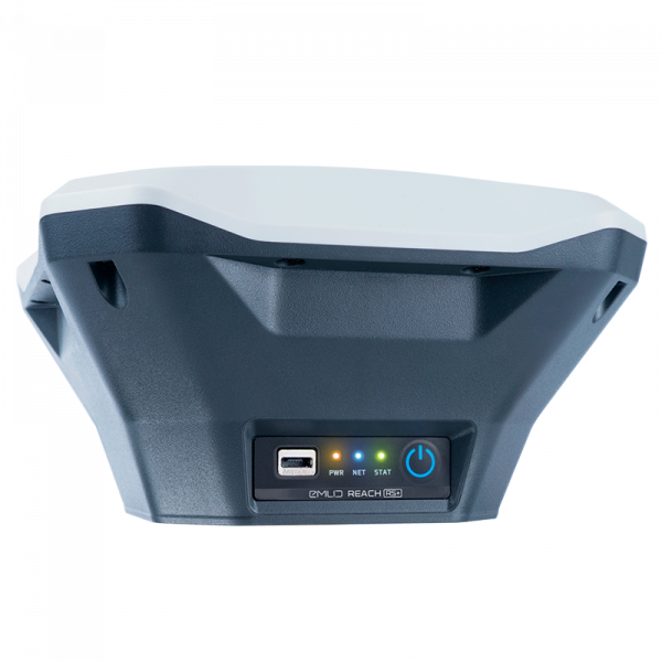
Reach RS+


Prices incl. GST
Out of Stock.
- Product Code: EM-RCH201
- MPN: RCH201
RTK GNSS receiver with an app as a controller
Centimeter accuracy for surveying, mapping and data collection.

GNSS
GPS, GLONASS, BeiDou, Galileo, QZSS and SBAS

Long range radio
LoRa 868/915 MHz, range up to 8 km

30 hours battery life
LiFePO4 battery, 5-40V input USB charging

Wi-Fi and Bluetooth
To connect to your device
Package includes:
— Reach RS+
— Carry case with a strap
— Radio antenna
— Adapter for survey pole
— USB cable
ReachView app

Reach RS+ comes with a cross-platform app. It is hosted on Reach itself and accessed via Wi-Fi connection on any smartphone, tablet or laptop. For the best experience get it’s mobile version for iOS or Android.

Collect points
With Reach RS+ and ReachView you can create survey projects to manage data collection. When working in the field each point is assigned a custom name and offset. Results can be downloaded from the project list.
1 cm 8 GB
Precision Storage
File formats: DXF, GeoJSON, ESRI Shapefile and CSV.

Use Reach RS+ as a base station
Use Reach RS+ to set up your own base station. Stream corrections over the network via NTRIP/TCP or LoRa radio. Record base logs for post-processing.
868/915 MHz Up to 8 km
LoRa radio Reliable corrections
File formats: RTCM3, RINEX.

Receive corrections data over the Internet
You won’t always need to set up your own base station. Standalone Reach RS+ can receive corrections data over the Internet from your local NTRIP provider. No special devices or software are required, all you need is a smartphone.
File formats: RTCM3, RINEX. VRS supported.
Machinery guidance
Reach RS+ is able to provide precise coordinates over Bluetooth/Wi-Fi to your tablet with a lightbar navigation app.
RS232 interface allows to connect Reach RS directly to an autosteer system.
File formats: NMEA, ERB, plain text
Compatible apps: MachineryGuide, AgriBus-Navi, Efarmer
Reach RS+ and ReachView are fully featured
ReachView app and all features are already included in price. No extra charges or subscriptions.
ReachView constantly improves and updates
Simply tap the update button to receive new features and advancements. It’s always free.
Protected from water, dust and falling
And it floats, so you don’t have to worry you might lose it in a middle of a lake
-20?…+65? IP67
-4F…149F Water- and dustproof
690 g 145 x 145 x 85 mm
1,52 lbs 5,7 x 5,7 x 3,3 inches